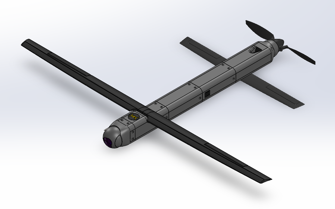
Overview
Engineered for Adaptability. Built for Performance.
Key Specifications
- Modular mission payloads (15 lbs max capacity)
- Over 95 Miles operational range
- 8+ hour flight endurance
- Low footprint and signature
- Flexible take off and landing capabilities
- GPS-denied & contested environment operation
- Modular, hot-Swappable multispectral sensors and navigation payloads
- Autonomous operation & programmable flight missions
- Encrypted datalinks
- Anti-jam & anti-spoofing capabilities
- Full Beyond Line of Sight (BLOS) operability
- Resilient in low connectivity environments
- NDAA Section 848 compliance available (per customer requirements)
- Advanced sensor fusion algorithms
Advanced Capabilities
Resilient Operations
Ensures mission continuity with redundant and encrypted communication protocols, robust anti-jamming and anti-spoofing capabilities, and full operational effectiveness in GPS-denied or contested environments.
Autonomous Intelligence
Autonomous operation with various programmable flight missions, onboard AI and edge computing drive advanced computer vision algorithms for real-time analysis, autonomous decision-making, target recognition, precision geotagging, and autoland capabilities.
Versatile Sensor Integration
Quick interchangeable sensor payloads supporting a wide array of modular options including high-resolution EO/IR gimbals, LiDAR for detailed 3D mapping, SIGINT packages, and sensors capable of Wide-Area Motion Imagery (WAMI) for comprehensive situational awareness.
Network-Centric & BLOS
Seamlessly integrates into existing networks with sophisticated datalinks, enabling fully operable Beyond Line of Sight (BLOS) missions and collaborative autonomous operations.
Rapid & Flexible Deployment
Engineered for swift deployment from diverse platforms including ground, mobile (vehicle), maritime (sea), or air launch systems with flexible take off and landing capabilities, ensuring operational readiness in dynamic scenarios.
Precision Geolocation
Advanced sensors provide high-accuracy geotagging for all collected data, including imagery and detected targets, crucial for actionable intelligence and precise targeting.
Fixed-Wing Advantage
The Setonar-One's fixed-wing design provides significant advantages for extended and demanding missions.
- Extended 8-hour flight time
- Over 95 Miles operational range (BLOS)
- Higher operational ceiling & speed
- Superior weather resistance
- Efficient for wide-area surveillance
- Stable platform for high-quality sensor data
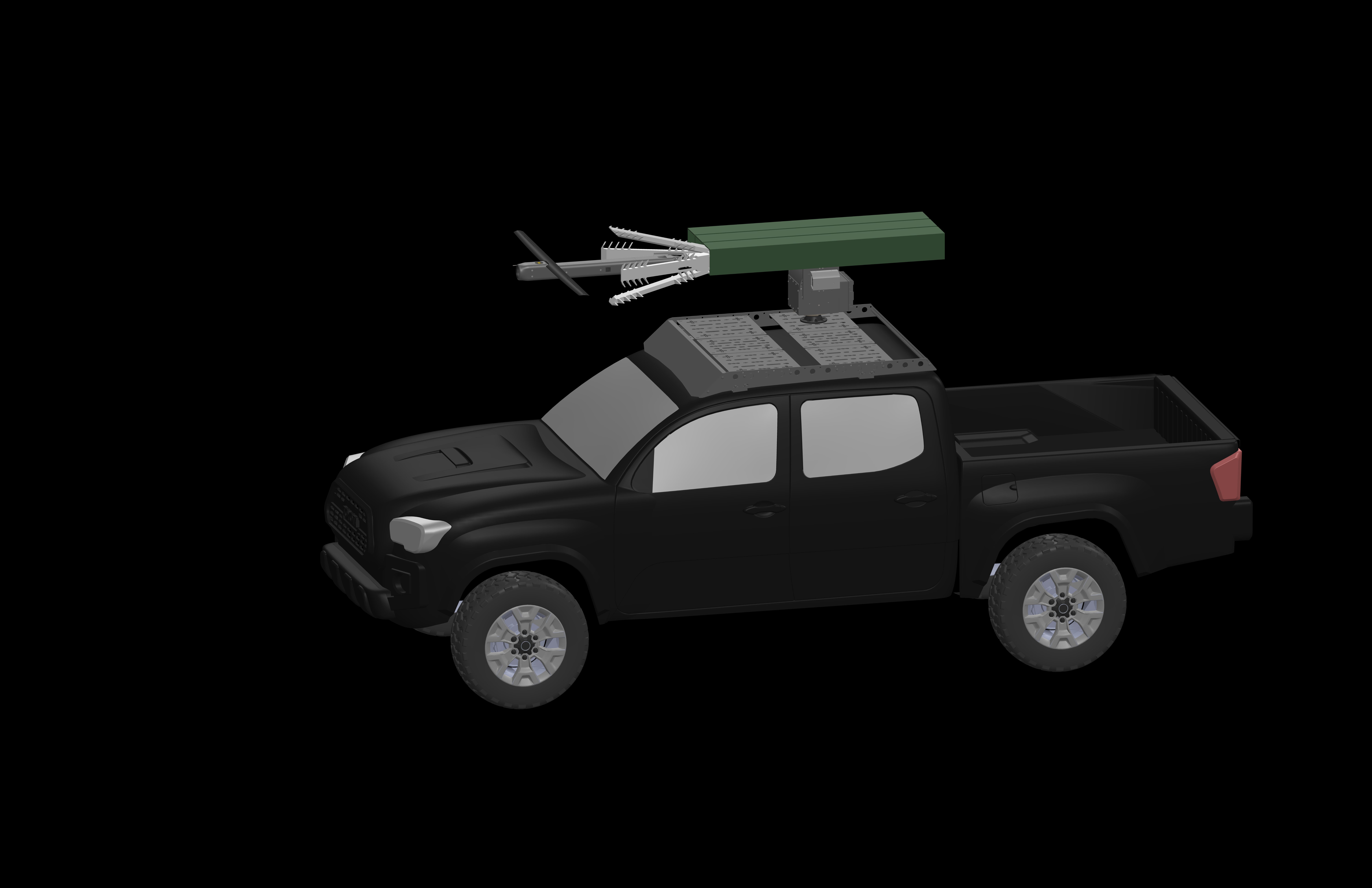
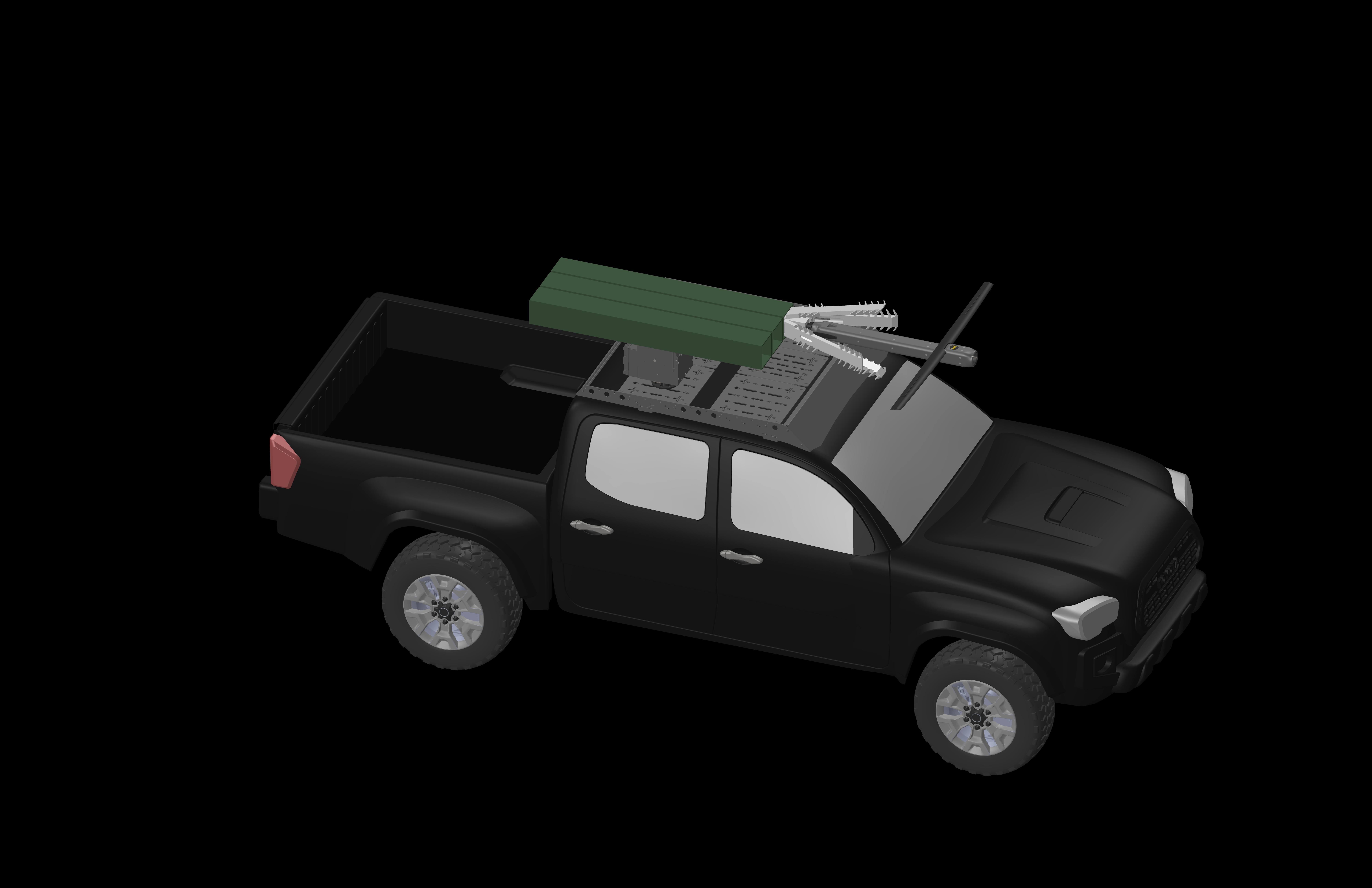
Vehicle Integration Kit (VIK)
The Setonar-One VIK transforms standard vehicles into mobile drone operations centers, enabling immediate deployment from ground or mobile platforms in critical situations with minimal setup time and flexible take off and landing options.
Sub-60-Second Launch
From vehicle to air in under one minute with the automated quick-release launch system and autoland capability.
Platform Agnostic
Compatible with SUVs, trucks, and maritime vessels with minimal modifications.
Integrated Power & Comms
Onboard power management for drone charging and secure, high-bandwidth communication links.
Mobile Command Center
Vehicle-mounted control station with real-time data transmission, processing, and analysis capabilities.
Moment's Notice Deployment
The Setonar-One VIK enables first responders and security personnel to deploy aerial surveillance within seconds of arriving on scene. The system's pre-flight checks, calibration, and launch sequence are fully automated, allowing operators to focus on the mission rather than equipment setup.
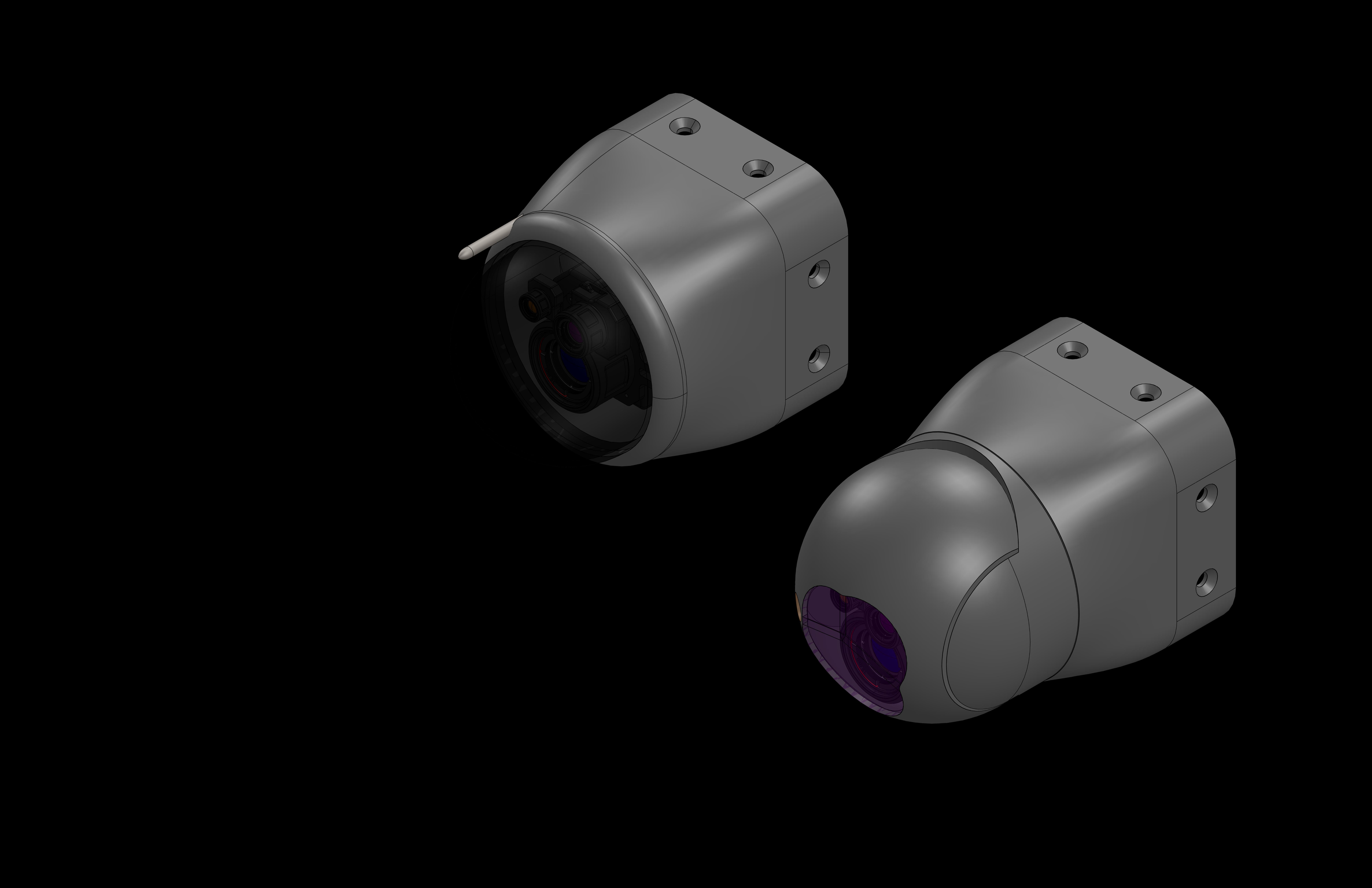
Modular Sensor Suite & Payloads
Advanced Multi-Spectral Sensors
Comprehensive sensor suite including Electro-Optical (EO), Long-Wave Infrared (LWIR), Mid-Wave Infrared (MWIR), and laser target marker sensors. Modular mission payloads provide exceptional clarity across all spectrums with precise geotagging and target designation capabilities. All sensor options support Autonomous Detection, Classification & Tracking for enhanced operational effectiveness.
High-Performance RGB
Ultra-high resolution visible spectrum imaging for detailed reconnaissance and surveillance
Multispectral Options
Advanced spectral analysis for vegetation monitoring and material identification
Thermal Imaging
LWIR/MWIR thermal sensors for heat signature detection and night operations
Panchromatic Options
High-sensitivity black and white imaging for enhanced detail and low-light performance
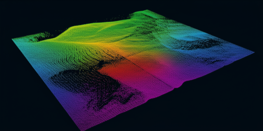
LiDAR, SIGINT & Custom Payloads
Integrate cutting-edge LiDAR for high-fidelity 3D mapping, SIGINT packages for signals intelligence, or custom-developed sensor payloads tailored to specific mission requirements, all with robust data-linking and quick interchangeable capabilities.